Asia-Pacific
Mangroves: NASA’s Landsat satellites show a global recovery of the forests since 2010
A Science study using Landsat images from 1984 to 2023 finds that the world's mangroves went from net loss to net gain around 2010, with almost 3,000 km² lost before and nearly 2,000 km² regained after. Myanmar is one of the sharpest reversals.

Mangroves, the coastal forests that grow in the salt water of tropical shores, have been recovering worldwide since about 2010, after decades of loss. NASA’s Earth Observatory presented the analysis of Landsat satellite images covering the years 1984 to 2023, published in the journal Science.
Mangroves are relatively small trees, averaging about 13 metres (43 feet) in height, but ecologically precious. Their ecosystems store up to four times as much carbon as the taller tropical forests of the interior and protect coastal communities from erosion and storm surge. Their stilt-like roots provide shelter and a nursery for fish, shrimp and crabs.
The researchers examined how the extent and the canopy density of the trees changed. From 1984 to 2010 almost 3,000 square kilometres of mangroves (about 1,200 square miles) were lost. After 2010, by contrast, a gain of almost 2,000 square kilometres (770 square miles) was recorded, mainly thanks to the expansion of forests in Asia, Australia and South America. The study’s summary says that global extent went from net loss to net gain around 2010, and that the overall change from the 1980s to 2023 was limited to −0.5% (±1.4%).
Many of today’s forests are also denser than in 2010, a sign that they are healthier and less degraded, especially in South America. Zhen Zhang, an environmental scientist at Tulane University, explained that two thirds of the expansion is due to mangroves colonising new areas and one third to the restoration and regeneration of degraded areas. “These are the first global mangrove maps covering such a long period,” he stressed.
At the mouth of the Amazon and in northern Australia, sediment deposition formed new mudflats that mangroves colonised, with steady growth since the 1990s. At the northern and southern limits of their range, including the southeastern United States, rising temperatures and fewer frosts allow the trees to advance into areas that were previously too cold, Zhang explained.
There are areas where losses exceeded gains. Large losses in the Niger Delta reduced the total area of mangroves in West and Central Africa after 2010, while in North America and southern Africa extensive degradation occurred after tropical cyclones destroyed large areas. “The global successes of the last decade should not become cause for complacency,” Zhang warned. He added that protection and slowing deforestation have great benefit when combined with natural expansion and regeneration.
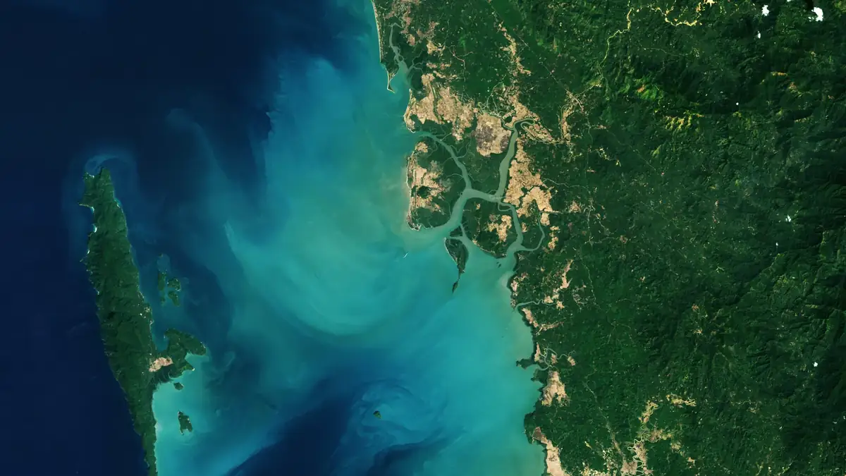
One of the most striking reversals took place in Myanmar (Burma). The country lost mangroves rapidly in the 1980s and 1990s because of the expansion of agriculture and aquaculture and the collection of firewood on the coasts. Around 2010 the trend reversed. The authors attribute it to greater awareness and restoration efforts after the deadly 2004 Indian Ocean tsunami, to stronger legal protection of forests, and to high sediment loads that created new mudflats ready to be colonised. The country had lost 28.6% of its mangroves from the 1980s to 2010, and since then their area has grown by about 10%.
Two Landsat images published by the Earth Observatory show Palaw township in Myanmar’s Myeik district, where mangroves have taken the place of rice paddies. The left image was taken on February 14, 2010 by the TM sensor of Landsat 5 and the right on February 2, 2026 by the OLI-2 sensor of Landsat 9. The regeneration is found mainly in abandoned rice paddies south of the village of Kyauktaung. On the nearby island of Pyin Bukyi residents have tried conservation and tree-planting programmes.
Earth observation from orbit also matters to Europe. ESA has issued the HELLAS-SPACE 2.0 call for Greek optical Earth-observation satellites, while the European CRISTAL ice-monitoring satellite, part of the Copernicus programme, has completed its assembly.