Cyprus
RFHUNTER for maritime surveillance: Cyprus’s SignalGeneriX system that passively detects “dark” vessels and USVs
Cyprus’s SignalGeneriX presented a coastal configuration of the RFHUNTER passive direction-finding and electronic support system for maritime surveillance, to spot dark vessels and unmanned surface vessels.

Cyprus’s SignalGeneriX has presented the new coastal configuration of the RFHUNTER® for maritime surveillance, carrying to the shore, ports and vessels a passive direction-finding and electronic support system known until now mainly in man-portable form for infantry, on vehicles and on drones. The company’s announcement from Limassol comes with four descriptors: award-winning, certified, operational and in use outside Cyprus. The problem it is meant to solve is familiar to anyone in maritime surveillance: many of the vessels that interest the authorities are precisely those that do not want to be seen, and a sensor that listens without emitting adds to the radar and AIS picture a piece of information they do not give: that someone is transmitting, on what frequency and from which direction.
What RFHUNTER does at sea and why passive operation matters
Radar detects the presence of a vessel but says nothing about its identity and intent. AIS (the automatic identification system on VHF) transmits a ship’s identity and movement data automatically and is mandatory for many classes of ship under the SOLAS convention, but it can be switched off or transmit inaccurate data, which limits its reliability as the sole surveillance means. A smuggling boat or a ship making an illegal cargo transfer simply turns off its AIS transponder and becomes what international terminology calls a “dark vessel,” while many small craft carry no AIS at all. If, however, the crew uses a VHF or UHF radio, a handheld transceiver or a drone link on a frequency within the 30 to 3,800 MHz range the RFHUNTER covers with the full set of three antennas, the emission can be detected and its bearing taken. HF links below 30 MHz and Ku-band satellite links such as Starlink are outside that range. That is exactly what the new configuration targets. In the company’s official material it appears as a sensor housed in a white radome on a fixed mast on the shore.
During detection and direction finding the sensor does not emit and so does not reveal its presence to the monitored transmitter, which the company sums up as continuous 24/7 operation that goes unnoticed. The optional wireless mesh networking does emit, so in a fully silent deployment the connection is made by cable. The sensor receives the signal through the antenna and, by comparing phase and amplitude differences between its elements, calculates the direction from which it comes, the so-called bearing. The method is correlative interferometry. One bearing gives only the line on which the transmitter lies. To obtain a position, measurements from two or more points are needed, either from different stations or from successive positions of a moving vessel, and by triangulation the system places the transmitter on a dynamic map. At sea this means two or three stations along a coastline, or one shore station and one RFHUNTER on a vessel, can give an estimated fix on a transmitter that does not appear on AIS and point the radar, camera or patrol boat toward the area to be checked.

SignalGeneriX lists the missions the maritime version is intended for: coastal and border surveillance, protection of the exclusive economic zone, Maritime Domain Awareness, countering smuggling and illegal migration, protection of critical infrastructure, port security with detection of “dark” vessels, search and rescue, and finally detection and location of unmanned surface vessels (USVs). Maritime drones, as seen in the Black Sea and the Red Sea, have a low silhouette and a small radar signature, and those that are remotely controlled use radio links to the operator or mother ship, though often also satellite links the sensor does not cover. When those links operate on frequencies within its range, a passive sensor that detects and takes bearings on them serves as a first-stage early warning. The company promotes integration with command and control (C2) systems and with counter-UAV (C-UAV) and counter-USV (C-USV) systems.
The technical characteristics of the sensor
The system is based on a sensor unit of 200 x 165 x 90 mm weighing under 5 kg without the antennas, which consumes just 7 W and in the portable configuration has an endurance of more than 10 hours of continuous operation. The 24/7 operation of a permanent coastal installation requires external power or recharging. The receiver has three I/Q channels, scans the spectrum at 0.5 GHz per second with a tuning resolution of 1.8 kHz, with a selectable direction-finding bandwidth from 3.84 to 30.72 MHz and a sensitivity of −85 dBm over a 10 MHz band, and, according to the published specifications, supports detection and processing of up to 2,048 signals, a capability not to be confused with simultaneous geolocation of as many transmitters. The official description provides for a wide scan to find signals of interest and then a targeted scan for more precise bearings. It detects emissions as short as 2.2 milliseconds and frequency-hopping signals (the technique where the transmitter changes frequency many times a second to resist jamming and make interception harder) at a rate of 450 hops per second, emission types found in some tactical radios and drone links. The detectable signal types the manufacturer states are CW, AM, FM and SSB, together with burst emissions and hopping signals. Bearing accuracy is given as ≤3° RMS in an open field, zero elevation angle and adequate signal-to-noise ratio.
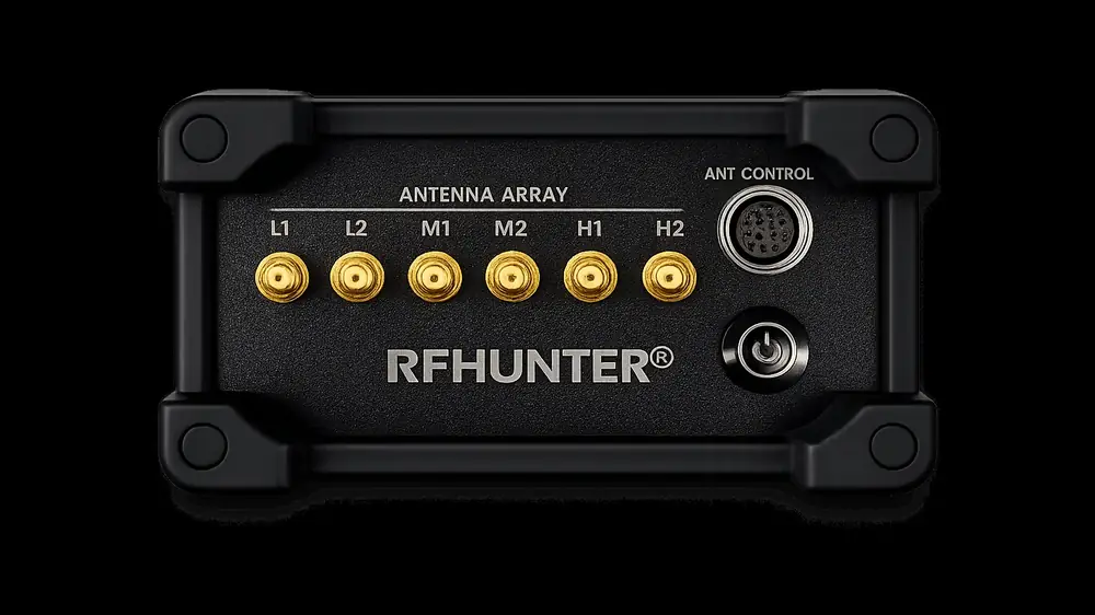
Spectrum coverage is by three direction-finding antennas for low, medium and high frequencies, each with five omnidirectional elements (four switched and one fixed) and 360-degree coverage. Each antenna covers its own frequency band and is replaced in the field with a quick-release connection, while full coverage of all three bands is offered as an option. The sensor determines its own position and orientation automatically, having a multi-constellation GNSS receiver and a tilt-compensated digital compass, which helps, although on a vessel roll, pitch and magnetic interference from the metal hull affect accuracy. Protection is IP67, operating temperature −10 to +50 °C, and connection is via Ethernet or, optionally, a wireless mesh network, which lets several units share data and jointly locate the same transmitter. The operator works on a rugged tablet with the RFHUNTER C2 application, where bearings appear as coloured lines on a tactical map, while the optional spectrum-monitoring function adds FFT and waterfall display and demodulation in six modes (WBFM, NBFM, AM, USB, LSB, CW), so the operator can listen to the analogue signals detected (digital and encrypted emissions can also be detected and direction-found, without this meaning the system can decode or make their content intelligible), without interrupting the direction-finding scan running in parallel.
From the soldier’s pack to the USV: RFHUNTER’s path
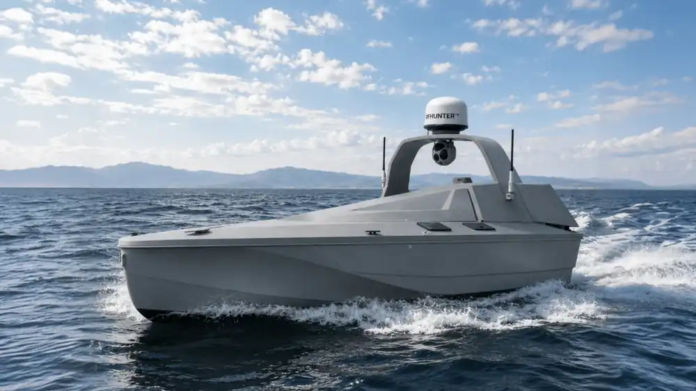
The naval configuration is the natural continuation of a product built step by step on the same architecture. RFHUNTER first appeared in Cyprus in January 2023 and a few months later, at DEFEA 2023, was presented as a man-portable system together with its airborne drone version. Next came integration into the Cypriot Poseidon H10 UAV (Eurosatory 2024) and the SIGFLY VTOL (2025), as well as the joint proposal with Greece’s EODH on the LEONIDAS 300 armoured vehicle at DEFEA 2025. In the European MarsEUs programme the system was integrated into MBDA’s AKERON turret on Milrem’s Type-X robotic vehicle, while in the European Defence Fund’s COMMANDS programme it was successfully integrated into Indra’s battle management system (BMS), installed on an ASCOD tracked vehicle, during trials in Seville in October 2025. In November 2025 the Cypriot National Guard and Ministry of Defence presented it in the “THESEUS” project on a quadcopter, and at Eurosatory 2026 it appeared on the Cypriot USV “Evagoras,” that is, already on a maritime platform.
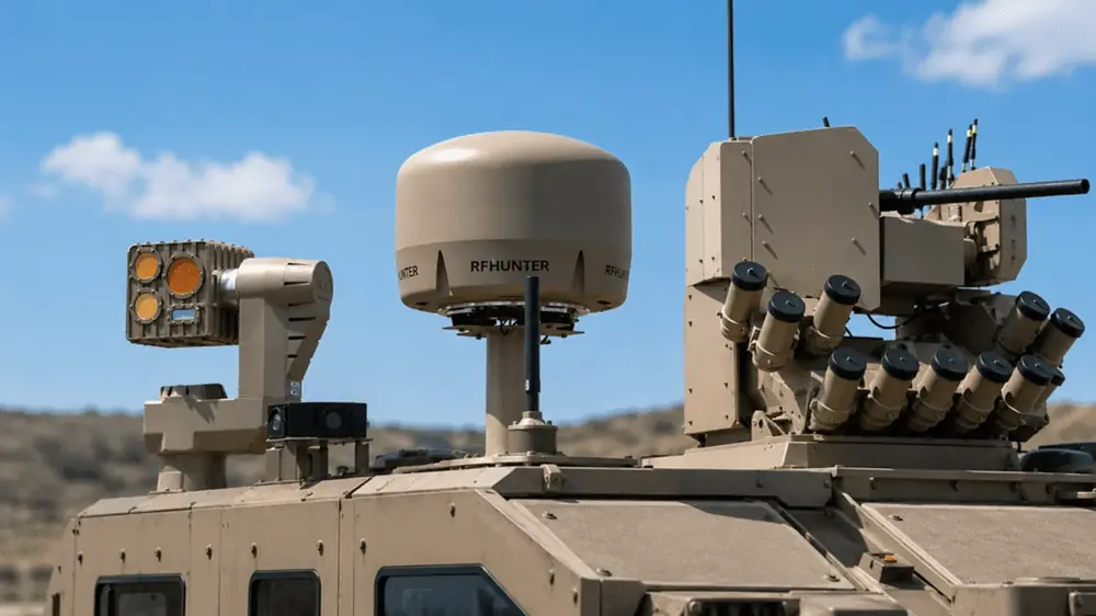
The “award-winning” label has specific content. At the Army Technology Excellence Awards 2024, SignalGeneriX won two awards for the RFHUNTER, in the Innovation and Product Launches categories, the first for combining software-defined radio (SDR) with advanced signal analysis and the second for the product’s rapid entry to market and installation flexibility. The company holds ISO 9001 quality and ISO/IEC 27001 information security certifications, and the system is designed and manufactured in Cyprus. The official product page, rfhunter.eu, now describes five configurations: portable, tripod, drone, vehicle or turret, and vessel or USV for maritime and river missions.
What it means for Cyprus and Greece
For two countries whose security is largely decided at sea, a light passive surveillance system of Cypriot manufacture fits specific needs. Cyprus has to monitor an EEZ with energy blocks and undersea infrastructure, while Greece has thousands of islands, flows of illegal migration from the Turkish coast and Libya, and undersea energy and communications infrastructure to protect. In that environment, a network of fixed RFHUNTERs on the coasts, linked with sensors on Coast Guard vessels and on USVs, could fill the AIS gap and flag in good time vessels that have switched it off but keep transmitting.
The RFHUNTER is not the company’s only product of interest to the region: SignalGeneriX has presented with France’s AeriX Systems the autonomous interceptor drone SPIDERAI and takes part in a series of European Defence Fund programmes. With the maritime version, the RFHUNTER moves from the role of a tactical sensor to that of a node integrated into wide-area surveillance architectures, which is where the real needs of the Eastern Mediterranean lie.