Greece
New round of NAVTEX south-east of Crete over the EMC cable: Heraklion declares the Turkish notice void, Antalya calls the Greek messages “unfounded”
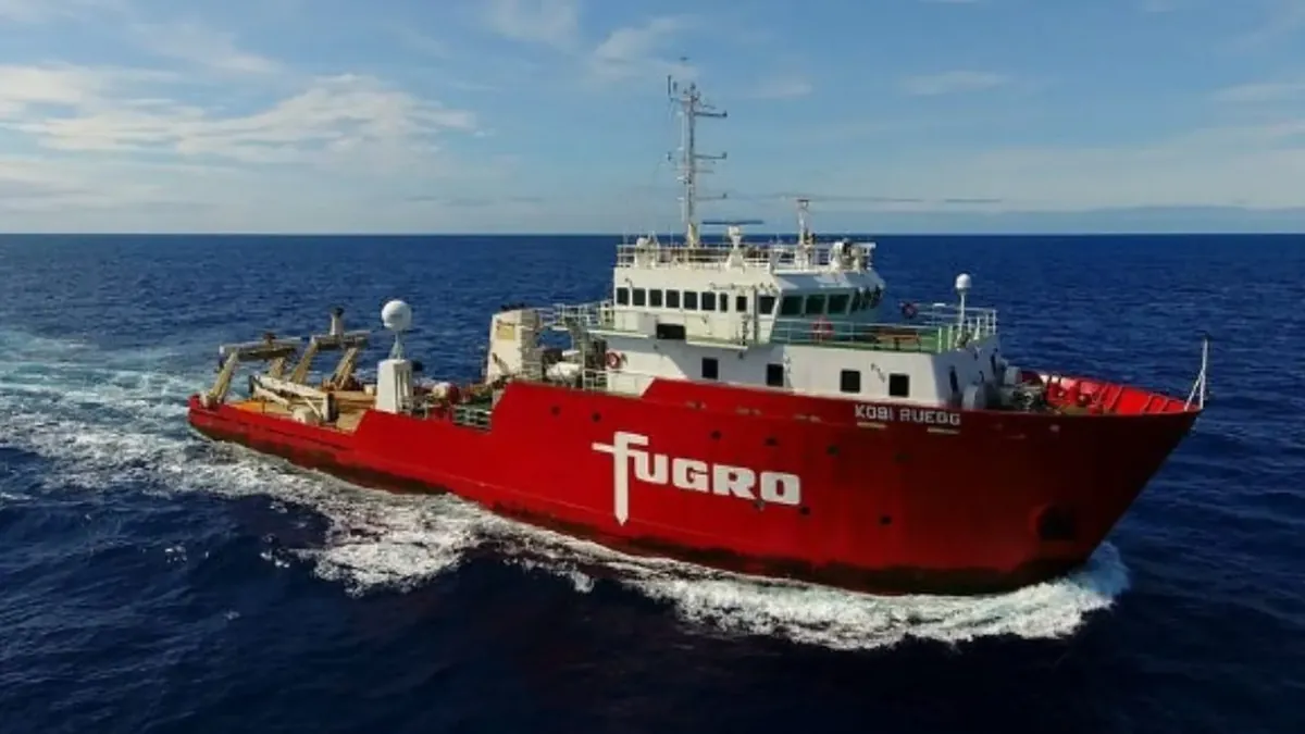
Four official messages in three days opened a new NAVTEX dispute south-east of Crete over the surveys of the KOBI RUEGG for the East to Med Data Corridor cable. Greece says the Turkish notice covers its continental shelf and EEZ.

Four official messages in three days opened a new round of NAVTEX confrontation south-east of Crete. The subject is the same as in the round of a few days earlier: the geophysical surveys of the ship KOBI RUEGG for the East to Med Data Corridor (EMC) undersea data cable. From October 26 to 28, the Turkish station at Antalya and the Greek station at Heraklion issued notices that challenge each other.
Ankara moved first. The Turkish Navy’s Office of Navigation, Hydrography and Oceanography (SHOD) published notice 1050/26 on Monday, October 26, revising the earlier 1032/26 “with the consent of the competent Turkish authorities”. The notice states that the KOBI RUEGG (IMO 9713753) has been carrying out surveys for the EMC since October 23 and until further notice, along two corridors 10 nautical miles wide. The corridors start from the 31st and 32nd meridians, south-west of Cyprus, and reach west to about 26°20′ east, south of Crete. A distance of 5 miles from the vessel is requested.
Heraklion’s answer: “unauthorised station”, “null”
The reply from the Hellenic Navy Hydrographic Service came on Tuesday, October 27, in two messages from the Heraklion station, NAVWARN 1361/26 and 1362/26, which appear on the Service’s NAVTEX page. The first describes the Turkish station as “unauthorised” and notes that the vast majority of the coordinates of 1050/26 lie on the Greek continental shelf and EEZ, “as defined by international law” and Law 4001/2011. Surveys in that area, it adds, must be conducted under the terms of Greek permit 2461/2.10.2026, and the area belongs to the responsibility zone of the Greek NAVTEX service, where the Heraklion station is exclusively competent. Conclusion: the Turkish notice is “null and void”.
The second Greek message announces the project itself on Greek terms: an undersea survey for the installation of a fibre-optic cable in the south-eastern Cretan Sea, by the KOBI RUEGG, in areas of the Greek EEZ and continental shelf, from October 27 to November 6. Its two lines reach east to about the 30th meridian, with a safety distance of 2 nautical miles.
Antalya insists
The Turkish side returned on Wednesday, October 28, with notice 1067/26. In it, Ankara argues that the Bahamas-flagged vessel is surveying “with the consent of the Republic of Türkiye” and “in accordance with international law” within what it calls the Turkish continental shelf, whose outer limits Ankara notified to the UN on March 18, 2020 in document A/74/757. It describes the Greek NAVWARN 1361/26 and 1362/26 as messages with “unfounded claims” from an “unauthorised station” inside the zone of the Turkish NAVTEX service, declares 1050/26 “valid and in force”, and says the Antalya station will continue to transmit NAVTEX.
The positions of the two sides repeat those of October 21, when Heraklion answered with a counter-NAVTEX to the Turkish 1032/26. Before that, the same KOBI RUEGG surveys for the EMC had prompted an exchange of NAVTEX between Cyprus and Antalya. The KOBI RUEGG is a survey vessel of the Fugro group.