Analysis
UNCLOS explained: sea zones, islands and the Aegean dispute
UNCLOS sets how far a coastal state's waters, resources and seabed rights reach. Here is what the treaty says on zones, islands and boundaries, and how Greece and Turkey read it.

The United Nations Convention on the Law of the Sea (UNCLOS) is the 1982 treaty that sets how far a coastal state’s waters, resources and seabed rights reach, and how neighbours should divide overlapping areas. In the Aegean and the Eastern Mediterranean it sits at the centre of the dispute between Greece and Turkey: Greece and Cyprus are parties to it, Turkey does not appear on the United Nations list of states that have joined, and the two sides read its rules on islands and boundaries very differently.
Key points
- UNCLOS divides the sea into zones: a territorial sea of up to 12 nautical miles, an exclusive economic zone (EEZ) of up to 200 nautical miles, and a continental shelf.
- Article 121 gives islands the same zones as other land, except for rocks that cannot sustain human habitation or economic life of their own.
- Neighbouring states must delimit overlapping zones by agreement, aiming for an “equitable solution”; the text says nothing more precise than that.
- Greece says all its islands generate full zones and that the median line is its outer limit until agreements are reached. Turkey’s foreign ministry says Aegean areas beyond 6 nautical miles are still to be delimited and that unilateral extension would be an abuse of right.
What is UNCLOS and who has joined?
UNCLOS was concluded on 10 December 1982. The United Nations keeps a chronological list of ratifications, accessions and successions; the most recent entry at the time of writing is Cambodia, on 6 February 2026, and the list numbers 172 entries. Cyprus appears as the 35th, on 12 December 1988, and Greece as the 78th, on 21 July 1995. Turkey does not appear on the list. See the UN chronological list for the full order.
That matters for the argument. Greece treats the Convention as binding treaty law. Turkey, outside it, still cites individual articles when it makes its own case, as described below.
What are the maritime zones under UNCLOS?
The Convention is built on distance from a coast. Each zone carries different rights, and the table summarises the main ones as written in the treaty.
| Zone | Reach | What the coastal state holds |
|---|---|---|
| Territorial sea | Up to 12 nautical miles from the baselines (Article 3) | Sovereignty over the waters, subject to the Convention |
| Exclusive economic zone | Not beyond 200 nautical miles from the baselines (Article 57) | Sovereign rights over living and non-living resources of the waters, seabed and subsoil, and over energy production from water, currents and winds (Article 56) |
| Continental shelf | Natural prolongation of land territory to the outer edge of the continental margin, or 200 nautical miles where the margin is shorter (Article 76) | Exclusive sovereign rights to explore and exploit seabed resources; the rights do not depend on occupation or proclamation (Article 77) |
Other states keep important freedoms inside an EEZ. Article 58 preserves navigation, overflight and the laying of submarine cables and pipelines. Article 78 adds that the shelf rights do not affect the legal status of the waters and airspace above. In other words, an EEZ or shelf is a bundle of economic rights, not a zone of full sovereignty.
Do islands get their own zones?
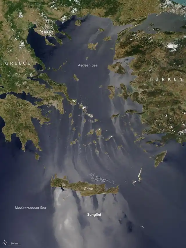
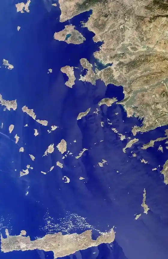
This is the question on which the Aegean turns. Article 121 begins with a definition: an island is “a naturally formed area of land, surrounded by water, which is above water at high tide”. Its second paragraph then says the territorial sea, contiguous zone, EEZ and continental shelf of an island are determined like those of other land territory. The third paragraph is the exception: “Rocks which cannot sustain human habitation or economic life of their own shall have no exclusive economic zone or continental shelf.”
The treaty does not define a “rock” and sets no size or population threshold. That gap is why the same article is quoted by both sides. Greece, in a note to the UN Secretary-General dated 3 September 2025, wrote that Article 121 “reflects customary international law” and that “all Greek islands enjoy maritime zones in the same way as any other land territory”.
How are overlapping zones divided?
Where coasts are opposite or adjacent, zones can overlap, and the Convention gives three separate rules. For the territorial sea, Article 15 says that, failing agreement, neither state may extend its territorial sea beyond the median line, unless “historic title or other special circumstances” call for a different line. For the EEZ (Article 74) and the continental shelf (Article 83), delimitation is to be effected “by agreement on the basis of international law” in order “to achieve an equitable solution”.
If no agreement is reached “within a reasonable period of time”, the states concerned are to resort to the dispute procedures in Part XV. Pending agreement, they are to make every effort to enter into provisional arrangements of a practical nature and not to jeopardize or hamper a final agreement. The text names neither the median line nor equidistance as the rule for the EEZ and shelf, which leaves room for each side to argue for its own method.
What is Greece’s position?
Greece’s argument rests on that reading of Article 121 and on a median line. In the same September 2025 note, the Permanent Mission of Greece explained that for sea areas with no delimitation agreement, the limits are set by the median line under Law No. 2289/1995, as amended by Law No. 4001/2011. It added that the median line defines the outer limits of the Greek continental shelf “until the conclusion of delimitation agreements with neighbouring States whose coasts are opposite or adjacent to Greece”.
Athens also points to agreements it has signed. The note lists the continental-shelf agreement with Italy of 24 May 1977, the Italy maritime-zones agreement of 9 June 2020, and the EEZ agreement with Egypt signed in Cairo on 6 August 2020, which Greece describes as concluded between states with opposite coasts and “in full conformity” with the Convention. The same note says Greece proclaimed an EEZ in the Ionian Sea through Presidential Decree No. 33/2025. Greek positions on the Aegean itself, and the general case for Greek and Cypriot rights, are covered in our explainers on the Treaty of Lausanne explained: borders, islands and minorities and on the Montreux Convention explained: who can pass the Bosphorus and the Dardanelles.
What is Turkey’s position?
Turkey’s foreign ministry states that the maritime boundaries between Turkey and Greece have yet to be delimited by agreement, that both countries presently apply a 6 nautical mile territorial sea in the Aegean, and that the continental shelf beyond those limits is also undelimited. It says that extending Greek territorial waters beyond 6 nautical miles would be an “abuse of right” and calls such a step “totally unacceptable”. On its own figures, Greek waters cover about 43.5 per cent of the Aegean today and would reach about 71.5 per cent at 12 miles, while Turkey’s share would rise from 7.5 to 8.8 per cent.
The ministry also argues from the Convention itself, even though Turkey is not on the list of parties. It says the 12-mile figure in Article 3 is “neither compulsory nor a limit to be applied automatically”, cites the abuse-of-right wording of Article 300, and points to the Article 15 reference to historic title and special circumstances. It further says any new maritime area in the Aegean should be based on the mutual consent of both countries, and refers to the Madrid Declaration of 8 July 1997 and the balance of the Treaty of Lausanne. These are Ankara’s claims, set out here as the ministry states them.
Has a court ever ruled on the Aegean?
Not on the merits. Greece brought the Aegean Sea Continental Shelf case to the International Court of Justice on 10 August 1976. In its judgment of 19 December 1978, the Court found that it had no jurisdiction: a reservation Greece made to the 1928 General Act excluded that route, and the Greek-Turkish press communiqué of 31 May 1975 was not an agreement binding the two states to unilateral referral. The Court’s own case page records this outcome, so no ruling on delimitation or on the entitlement of the islands exists.
Why does it matter beyond the Aegean?
The same Article 121 argument now shapes the Eastern Mediterranean. In its September 2025 note Greece rejected a claim by Libya that rests partly on the 27 November 2019 memorandum between Libya’s Government of National Accord and Turkey. Greece’s position is that the two states “have no common maritime boundaries because of the presence of numerous Greek islands, including Crete and the Dodecanese islands”, and that the memorandum “disregards the maritime entitlements of the Greek islands”. Greece also says the areas south of Crete lie within exclusive Greek jurisdiction.
Recent weeks have shown how this plays out in practice, with competing NAVTEX notices over survey work, covered in Counter-NAVTEX from Antalya for EUNOMIA: Turkey disputes Heraklion’s authority over the GSI corridor. Each notice is a small test of the questions above: who holds shelf rights, from which baselines, and whether an island counts.
What to watch for
Three points decide how any future talks or proceedings would run. The first is whether the parties accept the same legal text, since only some are bound by UNCLOS. The second is how islands are treated when a median line is drawn. The third is whether delimitation is pursued by agreement, as the Convention prefers, or through the dispute procedures in Part XV.
Sources: UNCLOS, Part II (and Parts V, VI, VIII on the same site); UN list of ratifications and accessions; Greece’s note verbale, UN document A/79/1005, 3 September 2025; Turkish Ministry of Foreign Affairs on the breadth of territorial waters; International Court of Justice, Aegean Sea Continental Shelf case.