Greece
HELLAS-SPACE 2.0: ESA tender for Greek optical observation satellites with up to 30 cm resolution
Greece is preparing its own constellation of optical satellites. The first HELLAS-SPACE 2.0 tender, run by the European Space Agency with the Greek ministry and the Hellenic Space Center, closes on December 23, 2026.

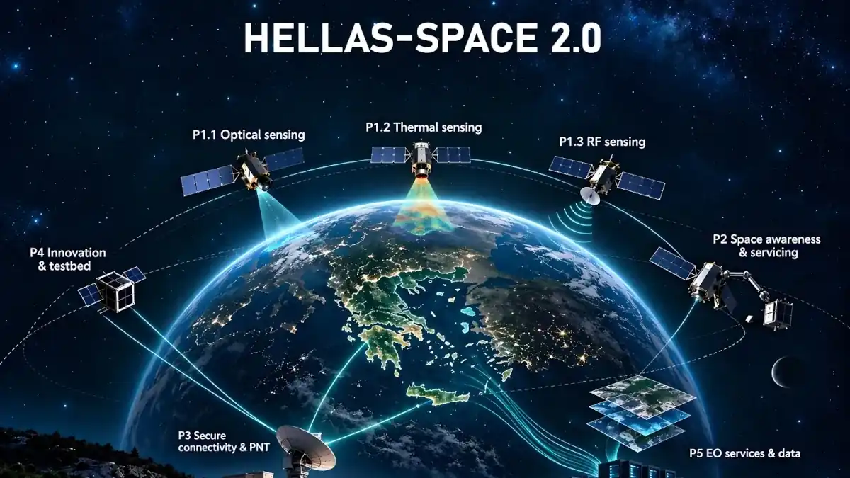
Greece is preparing its own constellation of optical satellites that will deliver images with a resolution of up to 30 centimetres. The starting point is a tender announced on Thursday, November 12 by the Ministry of Digital Governance and Artificial Intelligence, and also published on the website of the Hellenic Space Center (ELKED). It is the first tender of HELLAS-SPACE 2.0, the second phase of the National Space Programme.
The tender is run by the European Space Agency (ESA), together with the ministry and the Hellenic Space Center. The invitation to tender (ITT) is numbered 1-13758 and titled “Greek National Satellite Space Project P1.1 Sensing Layer: VHR RGB-NIR Optical Satellites”. These are very-high-resolution (VHR) satellites that record images in the three basic colours of visible light, red, green and blue (RGB), and in the near infrared (NIR). Bids are submitted on ESA’s esa-star Publication platform, and the deadline is strict: Wednesday, December 23, 2026, at 13:00 local time, as the notice specifies.
A complete system, from design to orbit
The contractor will take on the whole system, from the drawing board to delivery in space: construction, integration and testing of the satellites, launch, delivery in orbit, and the ground segment for controlling the constellation and processing the data. For Greece the benefit is frequent revisits over Greek territory and the wider Mediterranean, and less dependence on foreign providers.
What the images will be used for
The announcement lists specific applications. By comparing images taken in different periods, the competent services will spot new construction and check for possible unauthorised interventions in forests, coastlines and protected areas. In the same way, new deposits of material and changes in land use will show up, and with them possible illegal landfills. After wildfires, floods or earthquakes, the satellites will quickly map the affected areas and record damage to infrastructure, which matters for civil protection.
At sea, the new satellites will help locate vessels that do not transmit on the Automatic Identification System (AIS), the so-called “dark vessels”. This is done by combining many satellite data sets with navigation information, so that suspicious activity can be detected, illegal fishing curbed and the marine environment protected.
National space capabilities and Greek industry
For the programme itself, the aim of the second phase is for national space capabilities to remain viable over the long term, while strengthening technological autonomy and the resilience of Europe. The first tender opens the way for a series of later ones covering sensors, secure satellite communications, ground systems and data-exploitation services, as the announcement’s graphic shows. Priority goes to Greek industry, with a target of at least 50% participation and support for companies, researchers and highly specialised jobs.
HELLAS-SPACE 2.0 was presented in June at the “Greece in Orbit” event, where Digital Governance and Artificial Intelligence Minister Dimitris Papastergiou announced a four-year programme of about €350 million. It is financed by the Recovery and Resilience Facility and continues the €200 million National Microsatellite Programme.
Dependence on foreign providers has also concerned Greece’s defence leadership. At the inauguration of the Space Operations Command at Dekelia on Monday, November 9, National Defence Minister Nikos Dendias said that until now the country has bought such services from foreign suppliers. Two days later, on November 11, the €35 million HIIF investment in ICEYE was presented: see our report on Greece’s planned satellite factory for 150 satellites a year.