Analysis
Sea Fire: How the AESA radar on Greece’s FDI HN frigates works
How the Sea Fire AESA radar gives Greece’s FDI HN frigates continuous surveillance and supports their Aster air defence system.

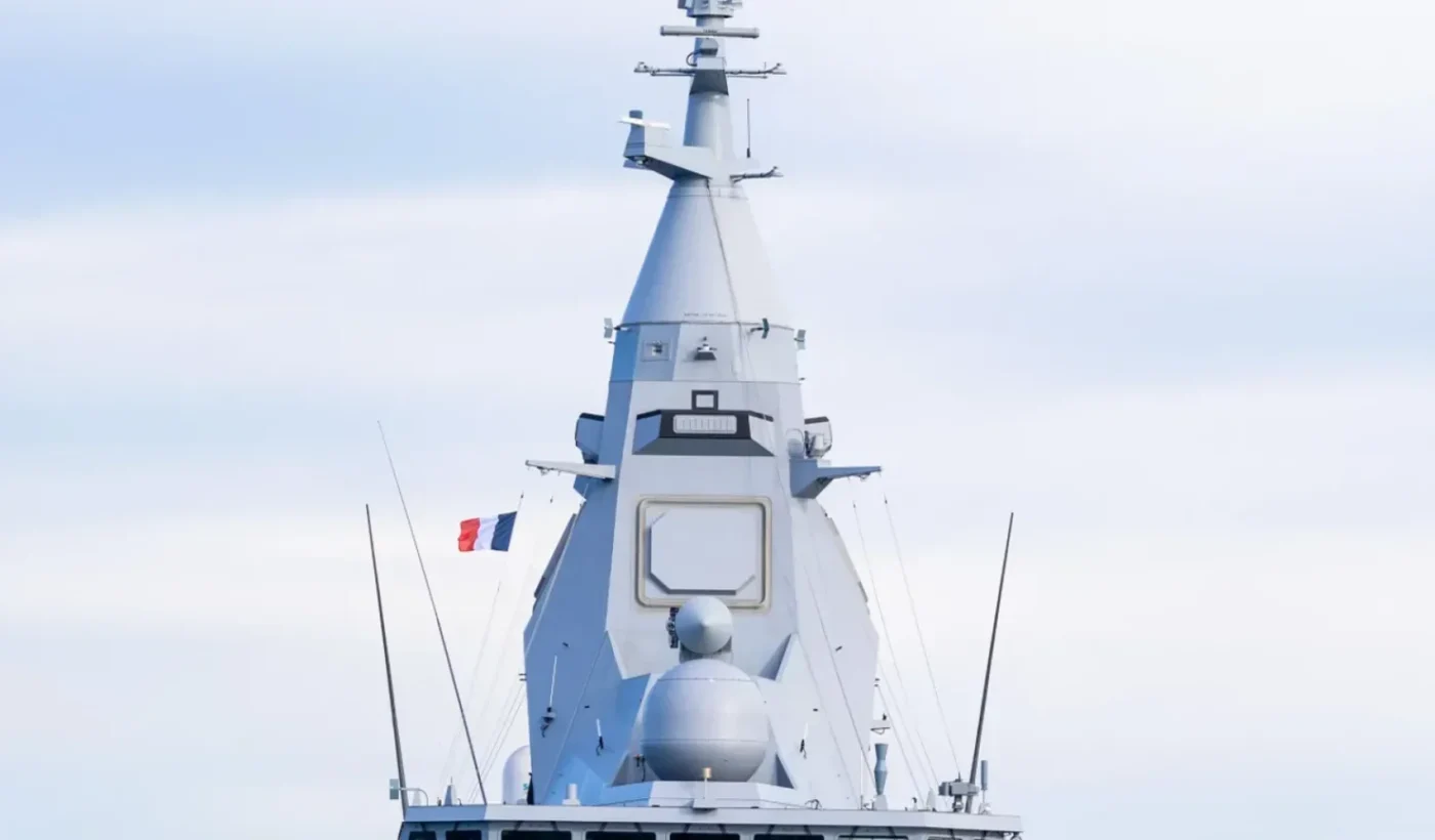
The Sea Fire radar is at the centre of the Hellenic Navy’s FDI HN frigates. Four fixed active electronically scanned antenna faces on the ship’s integrated mast provide coverage in every direction, while the radar’s digital architecture supports air and surface surveillance alongside fire control. For Greece, the system is part of a wider change in how its new frigates build and use a tactical picture at sea.
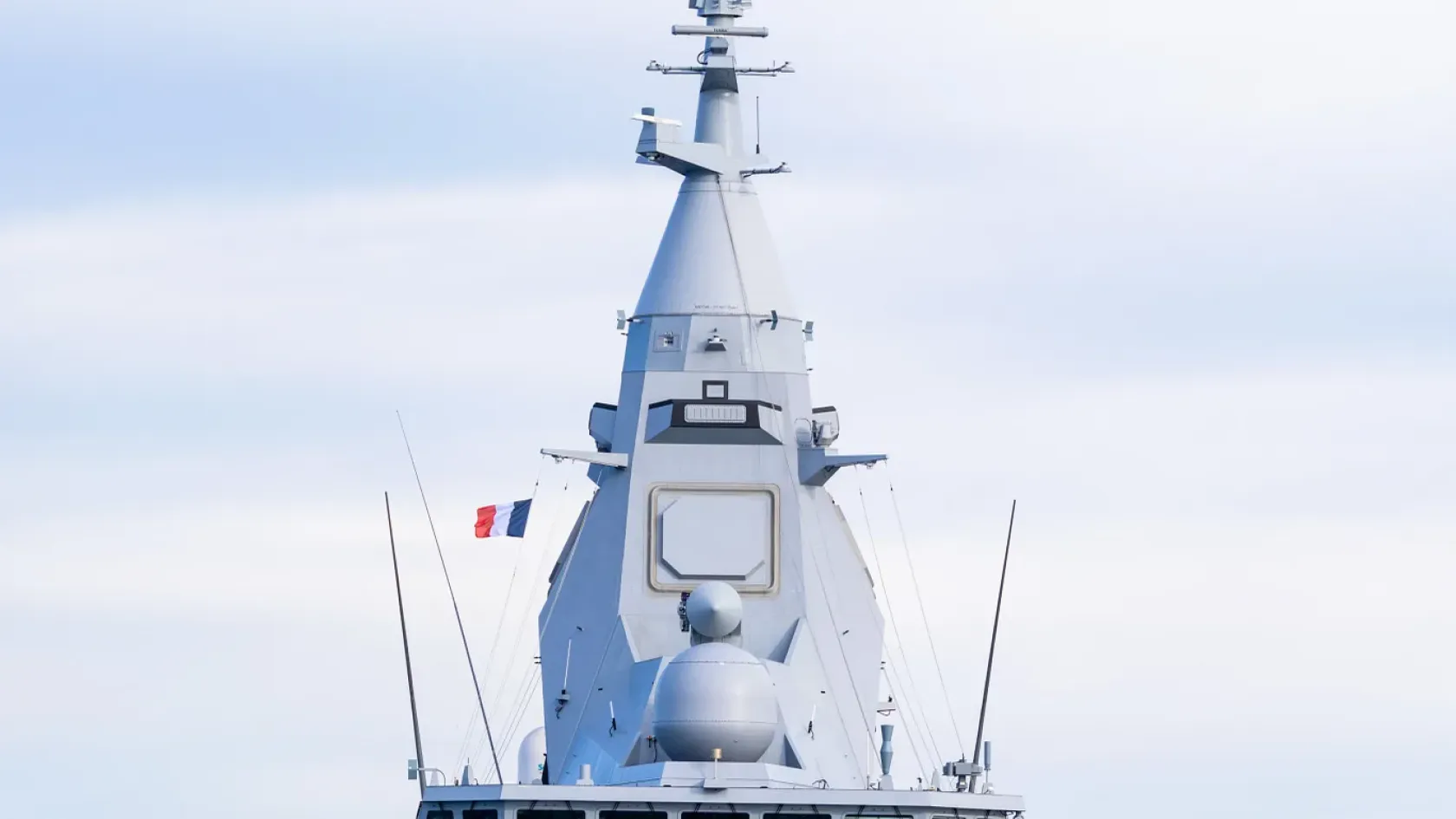
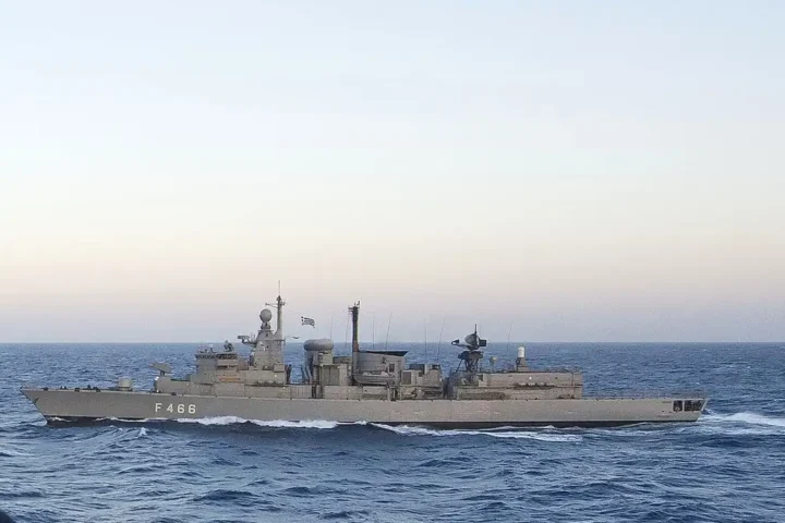
The first Greek FDI HN, Kimon (F-601), was formally welcomed into the Hellenic Navy in the Saronic Gulf on 15 January 2026. The ship carries the same Sea Fire radar family as the French FDI design. The significance of its sensor lies in how it connects detection and tracking to the frigate’s combat management system and Aster air-defence missiles.

Four fixed faces and a continuous view
Sea Fire uses an active electronically scanned array, or AESA. Instead of rotating a large antenna mechanically, its four fixed faces steer radar beams electronically across their respective sectors. The arrangement gives the ship continuous 360-degree surveillance and allows the radar to shift attention quickly between areas and tracks.
That does not make every part of the sky equally easy to observe. A low-flying missile can still be constrained by the radar horizon, while terrain, sea conditions and the target’s characteristics affect what the ship can detect. The fixed panels change the speed and flexibility with which the sensor allocates its attention; they do not remove the physical limits of radar propagation.
Thales describes Sea Fire as a fully digital multifunction radar that combines long-range air surveillance, surface surveillance and fire control. Its published specifications cite more than 300 kilometres of air coverage, tracking of more than 800 objects and coverage up to 90 degrees in elevation. These are manufacturer figures for the system, not a promise that every aircraft, drone or sea-skimming missile can be seen at the same distance.
From detection to a decision
A radar contact has to become a usable track before it can support an engagement. The frigate’s combat management system combines sensor data, evaluates threats and helps the crew decide how to respond. Tracking more than 800 objects is not the same as engaging 800 targets: weapon availability, launchers, ammunition and the tactical situation all matter.
The Greek FDI HN design pairs Sea Fire with the Setis combat management system and Aster missiles. Naval Group lists 32 Aster missiles among the Greek configuration’s principal weapons. The radar supplies surveillance and fire-control functions; the combat system and crew turn that information into decisions. The ship’s integrated mast brings together its air-facing sensors, allowing the frigate to maintain a picture around itself as part of a wider naval force.
That combination is especially relevant to the Hellenic Navy’s work in the Aegean and the Eastern Mediterranean, where a frigate may have to monitor aircraft, missiles, drones and surface contacts at once. The programme builds on the 2022 Greek–French agreement for the FDI HN frigates, which placed the Sea Fire among their defining sensors.
How digital scanning allocates attention
AESA stands for active electronically scanned array. Its transmitting and receiving elements are controlled electronically, so the radar can direct beams across a sector without turning a large antenna. The four fixed panels cover different sectors around the ship. Sea Fire can divide its operating time between searching a wide volume, revisiting a contact and supplying the information needed for fire control. That flexibility is particularly valuable when contacts approach from more than one direction.
The radar returns are processed into tracks: estimates of an object’s position and movement that can be updated as new measurements arrive. A track is not a visual identification or a decision to fire. The combat system must correlate sensor information, while the crew considers the nature and trajectory of a contact and the available response. The value of the digital radar therefore also depends on the quality and speed of its processing and on how its data are distributed aboard the frigate.
Aircraft, missiles and surface contacts
Thales lists long-range three-dimensional air surveillance, horizon search, surface surveillance and fire control among Sea Fire’s functions. These tasks make different demands on the radar. An aircraft at altitude, a low-flying missile, an unmanned aircraft and a vessel on the surface present different radar signatures and operating problems. Electronic scanning lets the system manage its resources across those tasks while keeping surveillance active.
The published range and track figures need that context. More than 300 kilometres of air coverage is a system specification; it does not describe the detection range for every target. The height of an incoming missile and the ship’s own antenna determine how far the radar can see near the surface. Sea conditions, geography and electronic interference may also affect the picture. Likewise, maintaining more than 800 tracks says nothing by itself about the number of missiles that can be fired or guided at a given moment.
Sea Fire aboard the Greek FDI HN
The Greek frigate joins radar, Setis combat management system and Aster air-defence weapons in a single shipboard chain. The radar searches and tracks; the combat system presents a tactical picture and supports threat evaluation and the allocation of weapons. Naval Group lists 32 Aster missiles for the Greek configuration. The number of available weapons and the readiness of the crew remain separate from the number of objects a radar can follow.
The Hellenic Navy welcomed Kimon in January 2026, making Sea Fire part of an actual Greek fleet programme. In the Aegean and Eastern Mediterranean, the frigate may work alongside other ships and aircraft. Sharing a timely picture with those units, maintaining tracks in crowded air and sea space, and supporting the protection of the wider formation are among the practical reasons the sensor and its integration matter.